13 June 2008
Che cosa?
Remarkably the day passed without any rain. We mostly uncovered the previously excavated trenches from last November. A nice Constantinian coin and some other "stray" finds. Tomorrow to some new areas.


12 June 2008
Arrabbiata
The title of this post is both the style of my pasta at lunch today and the state of the aforementioned deities. Having stopped raining briefly after lunch today, it started up again and new continues lightly. The eastern skies (over the Apennines) are clearer, but the forecast isn't very good...better than today, but not good.
Here's a photo of almost everyone in the Roman cistern at Todi.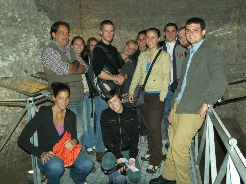
Here's a photo of almost everyone in the Roman cistern at Todi.
The Gods must be angry
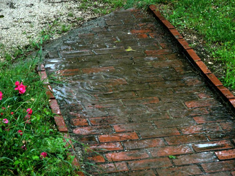
After a promising start yesterday, we had to stop after a fairly short - but drenching - downpour in the mid-afternoon. Today we awoke to rain.
Meanwhile at home, temperatures near 100 (low 30s, as they'd say here) and massive winds and power outages.
06 June 2008
Inscription
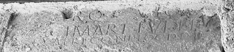
Well, as expected, all three inscriptions are in the CIL ("Corpus Inscriptionum Latinarum") volume that deals with this part of Italy, XI. Here's a photo of the inscription that gives the name of the site. I had to play with it a bit to get it to be readable (ok, mostly readable), so it appears to be in black and white, though it isn't. You can make out in the big second line "MART. TUDE" which is the middle of "Vicus Martis Tudertium", that is, "Settlement of the Mars of the people of Todi."
Sunday we plan to start the geomagnetic survey, in collaboration with Tomaso Mattioli from the University of Perugia. Should be good.
Someday the big trailer will arrive from the local town ('nuff said, if you know about Italian bureaucracy and work habits).
04 June 2008
Arrivato!
I arrived Sunday in Italy without incident, despite the massive thunderstorms on the East Coast during the day.
Spent the day with my colleague Carlo Zoccoli, visiting a few places, including the site of the excavations where we observed a few inscriptions embedded in the wall of the medieval tower next to the church. Two have been published already, but perhaps not the third.
The first is over the small door to the tower and reads:
PỌḄḶỊCIA·A·L·
SALVIA
The other two were noted by Becatti back in the 30s and include one of the inscriptions that mentions the place by name.
Today's lesson: Always Bring the Camera
Spent the day with my colleague Carlo Zoccoli, visiting a few places, including the site of the excavations where we observed a few inscriptions embedded in the wall of the medieval tower next to the church. Two have been published already, but perhaps not the third.
The first is over the small door to the tower and reads:
PỌḄḶỊCIA·A·L·
SALVIA
The other two were noted by Becatti back in the 30s and include one of the inscriptions that mentions the place by name.
Today's lesson: Always Bring the Camera
24 May 2008
Fun with Satellites
Drew prides itself on its incorporation of technology into learning. Me too...or maybe it's more accurate to say that I just like playing with computer stuff.
In any case, I'm incorporating a few fun technologies into the dig and courses for this summer, mainly to do with mapping. The first one relies on all those satellites the U.S. has put around the planet in order to provide itself (and incidentally the rest of us) with a fairly good idea of our position on the globe. These Global Positioning Satellites provide a constant stream of data that can be read with all sorts of GPS devices, and now I've got three of these babies: the GT-31 from Locosys. (I got mine from The Midwest Speed Quest link on that page. This is a windsurfing site: these units are waterproof and float.)
They don't show maps like the units found in cars, but they do track and store your position so that you can download it later. In fact you can create multiple tracks and save them onto an internal SD card for transfer to your computer. On your computer, you can run some free software that converts these files into numerous formats, including Google Earth's native kml and the file format for OpenStreetMap.org, which is how we're going to use them in Italy, but more on that another time.
 Meanwhile, here's a screen shot from Google Earth. I got hungry and went to get some hot-and-sour soup (gratuitous unnecessary personal information, just like a real blog!), and took along the GPS unit. You can see that my path isn't perfectly mapped - I didn't stagger all over the street on my way there - but it isn't bad either. (Click on it to download the Google Earth file.)
In principio...
I start this with the best of intentions...and enough self-knowledge to realize that my good intentions may not be enough, and this blog may fail miserably. Nevertheless it's meant to be a running account of our excavations in Umbria, starting officially in June, 2008. I won't be the only one blogging; expect to hear from students, collaborators and the occasional "special guest."
So stay tuned.
Subscribe to:
Posts (Atom)